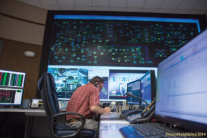
If I asked you to tell me what technology is used by electric cooperatives, you might think of things like electrical transformers, power lines, fuses, substations, and all the good stuff that allows electricity to flow safely and reliably to your home, and you would be correct!
What you might not think about are the various systems that work together to allow a co-op to operate at maximum efficiency and reliability while keeping overhead cost down and increasing safety to both the lineworkers and members.
Let us look at some of the new technology that has been embraced over the last decade, and how it works together for the benefit of the cooperative, its employees, and the members it serves.
Advanced metering infrastructure
AMI enables measurement of detailed, time-based information. AMI typically refers to the full measurement and collection system that includes meters at the members’ site, communication networks between the member and electric co-op, and data management systems that make the information available to the co-op.
It can also help identify outages. For instance, if your neighborhood power is down, the cooperative would not be able to receive readings from the meters at your residence. This can be valuable information when determining the source of the outage.
Outage management system
OMS maps system data and meter locations into a piece of software that models the electric grid. Eventually, there will be a power outage despite the best efforts of your electric co-op. That is where AMI and OMS earn their keep.
The basic element of an AMI is a meter that can communicate with your electric co-op. When a device on the grid reports loss of power, the OMS runs calculations to determine the exact location of the fault and the number of members impacted. The co-op dispatcher can call out or redirect a crew to the exact location of the problem. A map of the outage and number of impacted members is generated, and member service representatives are notified that an outage is in progress.
Geographic information system
GIS is digital mapping software that locates and identifies co-op assets like lines, substations, transformers and meters. Integrated with other software, it can provide a detailed picture of what is happening across a co-op’s distribution network.
“It’s the central IT system for engineering and operations of distribution utilities because every bit of planning and operational work you do is on these assets,” says David Pinney, NRECA program manager for analytics. “It’s just the intuitive way to understand what’s going on. I think it’s been revolutionary in the sense of situational awareness.”
Automatic vehicle location
AVL has full visibility into the location and activities of vehicles, and wireless communication allows better connection and coordinates the field and the office. Real-time insight into field activities means co-ops can respond quicker with more accurate information.
Cooperatives answering the call for assistance from another storm-damaged co-op can selectively offer to share their AVL data with the system of the co-op needing assistance. By doing so, the receiving system now can see the lending cooperative’s shared vehicles on its AVL system map.
A primary benefit of this AVL solution is improved crew safety. With all the activity of a major storm restoration event, there is added concern in ensuring crews are not dispatched into areas currently being restored by other crews and they are not endangering each other.
While each of these systems offer benefits all on their own, they work together to provide optimum efficiency. The result is less outages with shorter durations, increased safety and availability of up-to-date information.


